Delaware Ohio Recreational Trails GIS Collaboration
John Krygier
Department of Geology and Geography
Ohio Wesleyan University
jbkrygie@owu.edu
Krygier WWW Pages

- Article about the trails collaboration in the Delaware (Ohio) Gazette Friday November 22, 2002.
Urban greenways and recreational paths have become a vital part of the
development plans of many cities, offering an alternative means of
transportation as well as recreational opportunities and the green, open spaces
that many people want in their neighborhoods.
The City Of Delaware (Ohio) Recreation Department, community members, and
students and faculty in the Ohio Wesleyan University Department of Geology
and Geography have collaborated to develop a detailed proposal for a
recreational path system for the City of Delaware. The project involves
researching, mapping, and analyzing (using Geographic Information Systems and
GPS) a system of bicycle paths that connect neighborhoods, schools, commercial
areas, and recreational facilities throughout the city.
The City of Delaware Recreational Trails Project has benefited all involved:
students are learning GIS and mapping technologies in a 'real-world'
application, as well as learning about the trails and urban planning process in
general. City residents have received technical and research assistance from
OWU faculty and students, enabling them to complete their vision for a
comprehensive system of Recreational Trails in the City of Delaware. Finally,
the City of Delaware has gained a detailed plan for a project seen as having a
very important and positive impact on the quality of life in the City of
Delaware.
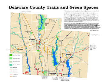
In the spring of 2003 this project was expanded to encompass the entire county.
Included in the project is an additional and related project: mapping 'green spaces'
in the county. The Delaware County Ohio Trails and Green Spaces map is a preliminary
attempt to begin a comprehensive overview of existing and potential trails and
green spaces in the county.
Last updated: 1/8/04
History of the Collaboration
- Spring Semester 2000 Geographic Information Systems Course (Geog 355)
- Chose project oriented approach: 'practicum' 'service learning' 'community collaboration'
- Extensive County GIS data: Delaware Co. DALIS Project
- Newspaper article Fall 1999: short recreational trail segment established near Olentangy River in Delaware
- Local interest in recreational trails, but no specific plans beyond the single trail
- Course project: use GIS (and GPS) and County data to locate and map out other potential trails in City
- Course format
- Review basic GIS concepts and analytical capacity (lecture and discussion)
- Learn the GIS software (ESRI) via tutorial and exercises (using local GIS data)
- Plan and engage in using GIS to develop a city-wide recreational trails plan
- Results of course project
- Rowland Smith: community member, bike enthusiast, City Recreation Committee
- Collaborated with students to refine and expand plan
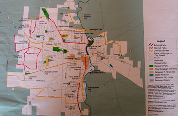
- Poster-map of Bikeways Plan by OWU Students and Rowland Smith
- Rowland Smith: promoted plan among city government and citizens using map
- Ohio Campus Compact Grant to further Community/Campus collaboration
- Spring of 2001: City Recreation Planner Hired: Randy Smith
- Had seen recreational trail plan when interviewed
- Recreational trails one of his top priorities
- GIS students worked with Smith Spring of 2001 and Spring of 2002
- More trails added to plan, inventory of natural and human phenomena along
trails (collected with GPS; attribute data added to GIS); also literature
on trail development: data passed along to Smith's GIS specialist
- OWU funding for student assistantship to continue work on project (StAP)
- OCC Student Fellowship and Summer Research Grant: Tim Hawthorne
- Trails Plan now art of City Master Plan
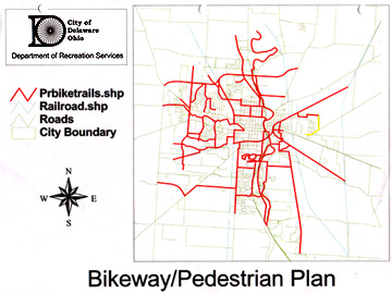
- Current Bikeways Plan (City Recreation Department): Randy Smith
Importance of the Collaboration
- For OWU and OWU Students
- OWU's History of outreach and service; community relations
- actual data and 'real' analysis problems: apply concepts, software to real project
- politics and planning and community issues
- the difference between 'tidy' digital maps and the actual 'messy' landscape
- learned much about the community
- appropriate for a liberal arts setting, Geography (not GIS) majors
- spin-off student projects: research and fellowships
- For the City of Delaware
- a 'jump start' on a good and desired project that city planners and
community members did not have enough time or resources to complete themselves
(rapidly developing area: among fastest development and population growth in state)
- technical assistance (GIS, GPS) and student hours doing the work
- Federal/state funding for several trail segments acquired
- abandoned RR corridor through city acquired (article above)
- development and planning decisions now made with recreational trails plan as
part of the process
- Subdivision developers: % of development set aside for trails (linear
rather than areal parks); must meet standards and connect to city plan
Necessary Components of GIS Community/University Collaboration
- Faculty member willing to engage in such a potentially 'messy' project
in domains beyond faculty expertise (eg., planning)
- Students with an interest in GIS applications (vs. programming, etc.)
- Good existing GIS data: lack of data can doom such collaborations
- Funding and support: OCC, OWU funding for students (and technology)
- Technology: GIS software, GPS for supplemental data
- Willing collaborators: vital to find collaborators that have the knowledge, time,
and enthusiasm to work with faculty and students
- Willingness to carry through with actual project: problem with university/community
collaborations: everything ends when the semester ends: ethical?
Some Interesting Issues resulting from the Collaboration

- Current Bikeways Plan (City Recreation Department): Randy Smith
- Recent acquisition of CSX Rail Corridor through city
- Consequences of making the map 'real' in the landscape
- Student/Faculty Research: Mental Maps and Public Participation GIS
- Paper on project submitted to the journal Environment and Planning A
entitled "Mapping Ambivalence: Participatory GIS Methods, Qualitative Data, and
Rails-to-Trails Development in a Changing Human Landscape" (Krygier and Hawthorne)
- New OWU GIS Facilities

- Historic RR Bridge over Olentangy River: Delaware now owns the RR Corridor and bridges
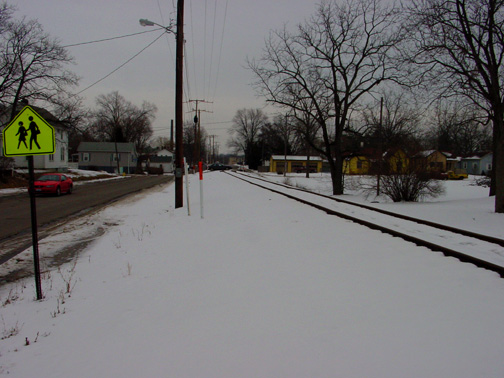
- CSX Tracks south of OWU Campus: Social Divisions: the 'other side of the tracks'
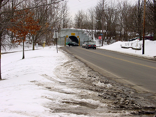
- Historic RR Tunnel: Traffic vs Trails
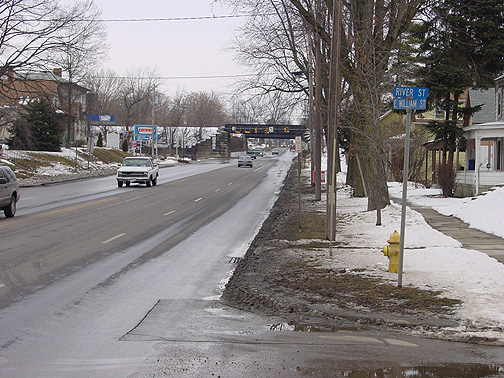
- Historic RR Bridge over Williams St.: Traffic vs Trails
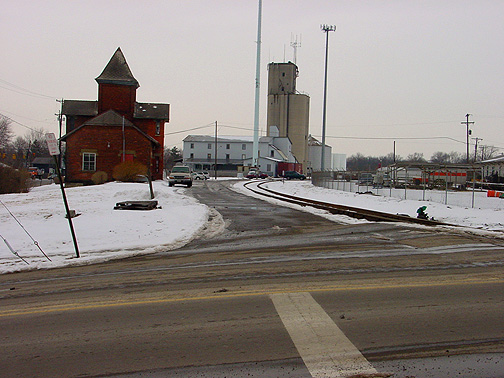
- Historic RR Depot: Development of the 'other side of the river'
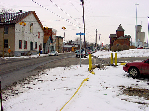
- RR Depot commercial strip: tattoos and biker bars
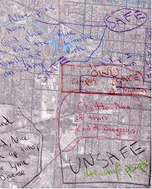

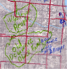
- Community Mental Mapping Project (Hawthorne): PPGIS: Mapping the Perceived Landscape with GIS: important GIS data
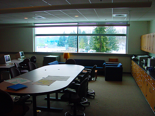
- New OWU GIS Lab: classroom space designed for collaborative projects
Spring 2004 and Future Projects
- Continued work on County-wide map of recreational trails and green spaces (Spring 2004: draft below)
-
- Conference: Mapping Campus-Community Collaborations:
Integrating Partnerships, Service-Learning, Mapping and GIS
E-mail: jbkrygie@owu.edu
...back to krygier top page.
...to krygier research page.
OWU Home
OWU
Geology and Geography Home


